Flood Types & Causes
Flooding occurs when water temporarily covers land that is usually dry. Depending on its severity, flooding can affect people, property, and the environment. A floodplain is a low-lying, relatively flat area of land near water that is prone to flooding.
Types of flooding in Nova Scotia:
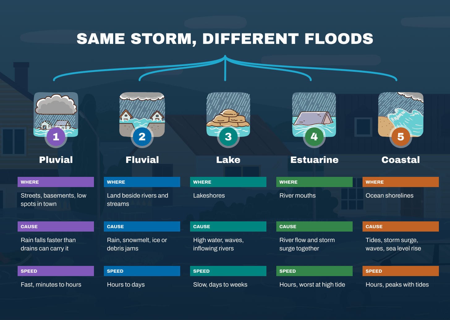
- Pluvial Flooding: Flooding caused by heavy rainfall that overwhelms drainage, not by rivers or lakes overflowing.
- Fluvial/Riverine Flooding: Flooding when a river or stream rises and spills over its banks, often from heavy rain, snowmelt, or blockages like ice jams.
- Lake Flooding: Flooding from rising lake water levels, often due to high water, waves, storm surges, or nearby river flows.
- Coastal Flooding: Flooding along ocean shorelines caused by high tides, storm surges, waves, or rising sea levels.
- Tsunami Flooding: Flooding from large waves caused by events like earthquakes, volcanic eruptions, or landslides. This type of flooding is rare.
- Other Types: Flooding can also result from dam or levee failures and sewer system issues.
What contributes to flooding?
- Extreme Precipitation: 48-hour rainfall events with Annual Exceedance Probability (AEP) of 5% and 1%, meaning each year (on average) there is a 5% or 1% chance of those rainfall amounts occurring.
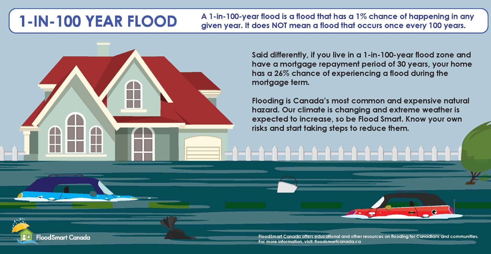
- Return Period - another way to communicate the frequencey and rarity of extreme preciptation events is the 1-in-20 and 1-in-100 year storm. This means that over a long period, a storm of this size occurs on average every 20 years or every 100 years. It does not mean that it happens every 20 or 100 years like clockwork. Every single year resets the odds.
- Winter rainfall events should also be considered, when the ground is frozen and assumed to be impervious, leading to increased runoff.
- Coastal Water Levels:
- Higher High Water Large Tide (HHWLT) , which is the average of the highest high waters each year over a period of 19 years;
- Storm surges, which are created by meteorological effects on sea level, such as wind set-up and low atmospheric pressure;
- Sea level rise due to climate change.
Other factors based on geographic areas:
- Riverine Floodplains:
- Snow accumulation and snowmelt during a rainfall event, which may contribute additional runoff;
- Ice jamming;
- Debris jamming;
- Dam operation, where discharge from a dam may contribute to increased water levels downstream;
- Hydraulic structure operation, such as weirs, gates, orifices, penstocks, flow diversions or pumps that can impact flows or water levels;
- Seasonal conditions, such as seasonal changes in the soil and vegetation cover that can affect infiltration and surface runoff.
- Coastal Floodplains:
- Short wave processes, such as wave setup, wave runup, and wave overtopping;
- Long wave processes, such as tidal amplification and Seiching;
- Tsunami is typically not accounted for in flood studies in Nova Scotia, because of the low risk posed by Nova Scotia′s position on a trailing-edge plate margin (the last occurrence was in 1929 off the coast of Newfoundland).
- Estuarine Floodplains: estuaries may be affected by riverine as well as coastal flood mechanisms. As such, extreme rainfall and storm surge may have to be considered jointly. Storm systems can lead to co-occurring storm surges and extreme rainfall. In this case, it is important to consider them jointly because the impact on water levels of their co-occurrence is greater than the sum of their individual impacts.
- Future and Climate Change Conditions:
- Additional development scenarios, such as changes in the state of development of the watersheds, the state of the drainage system, and implementation of future stormwater management practices;
- Climate change: Since the principal use of flood maps is to inform Land Use By-laws and Municipal Planning Strategies, the maps should provide insight into future conditions. As such, climate change will form a necessary part of future conditions analyses and needs to be carefully considered.
Financial support for this project was provided in part by Natural Resources Canada through the Flood Hazard Identification and Mapping Program (FHIMP). We also gratefully acknowledge the funding and support provided by the Government of Nova Scotia through the Municipal Flood Line Mapping Program (MFLMP).

