Floodplain Risk Assessment
Flood Risk Areas
In Nova Scotia, flood risk areas identified on floodplain maps are subject to the Statements of Provincial Interest regulations under hte Municipal Government Act (Department of Municipal Affairs and Housing, 2024). These regulations outline general restrictions to account for the hazards associated with flood risk areas. Floodplain maps are required to show flood risk areas, which are divided into two parts:
- The floodway: The inner area where flooding occurs most frequently. There is about a 5% chance of flooding each year in the floodway, also commonly known as the 1 in 20 return period.
- The floodway fringe: The outer area where flooding occurs less frequently. There is about a 1% chance of flooding each year, also commonly known as the 1 in 100 return period.
Flood risk areas identified on floodplain maps are subject to regulations outlined under the Municipal Government Act through the Statements of Provincial Interest (Department of Municipal Affairs and Housing, 2024). These regulations outline general restrictions to account for the hazards associated with flood risk areas.
Understanding Flood Risk
While floodplain maps help municipalities to visualize exposure to floods, municipalities may pursue a more detailed flood risk assessment in their jurisdiction. Flood risk is based on three key elements:
- Exposure: The people, buildings, and infrastructure located in an area that may flood.
- Vulnerability: The conditions (e.g., physical, social, economic, and environmental) that can be affected by a flood.
- Consequence (i.e. ‘Risk’): The economic, social, or environmental impacts that may result from a flood event. Consequence is typically defined by exposure multiplied by vulnerability.
Flood Risk Assessment is the process of evaluating the likelihood and potential impact of flooding on a particular area, community or asset. It involves analyzing the combination of flood exposure, vulnerability, and consequence to determine the level of risk and inform decision-making for flood risk management and mitigation (Government of Canada, 2022a).
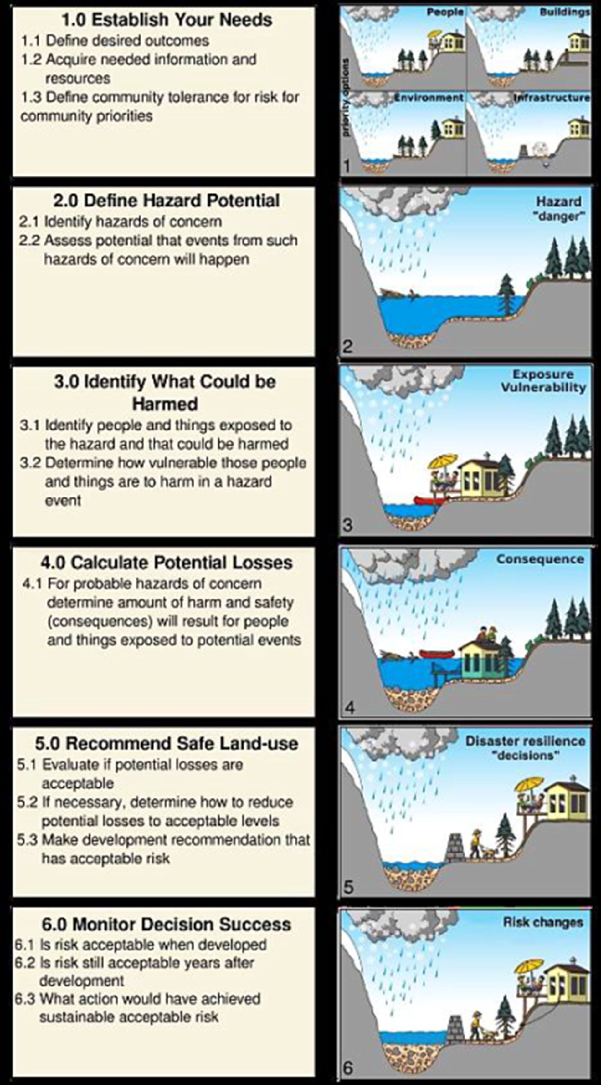
Figure 3-1: Land-use Risk Management Framework, Where Risk is the Probability of a Consequence (Government of Canada, 2022a)
Flood Risk Assessment Steps
The general steps involved in completing a Flood Risk Assessment are:
- Establish Your Needs: Defining outcomes and risk tolerances and acquiring information and resources;
- Define Hazard Potential: Identify flood hazards, assess potential for these events to occur;
- Identify What Could be Harmed: Identify people and things exposed to flood hazards and determine their vulnerability;
- Calculate Potential Losses: Determine the amount of harm and safety consequence for people and things exposed to flood hazards;
- Recommend Safe Land-use: Make recommendations for safe land use to help reduce risk to acceptable levels;
- Monitor Decision Success: Monitor flood risk overtime and re-evaluate as needed.
In the province of Nova Scotia, flood hazard mapping is being undertaken within the framework of the Municipal Flood Line Mapping Program, with the aim of creating detailed, up-to-date flood hazard maps using advanced technologies like LiDAR and hydrologic modeling. Further information is provided in Flood Mapping.
Financial support for this project was provided in part by Natural Resources Canada through the Flood Hazard Identification and Mapping Program (FHIMP). We also gratefully acknowledge the funding and support provided by the Government of Nova Scotia through the Municipal Flood Line Mapping Program (MFLMP).

