Town of Truro Flood Risk Study
Location and Flood Zone Description
The Salmon River floodplain (shown in Figure 6-9), has a history of frequent flooding events and high flood risk. This high flood risk prompted the Town of Truro, which is located on the south side of the Salmon River floodplain at the eastern end of Cobequid Bay, to perform a flood risk study (CBCL, 2017). The purpose of this flood risk study was to understand the overall flooding problem and formulate an implementation plan.
Flood Zone Adaptation Approach
Several steps were followed to complete the flood risk study for the Town of Truro:
-
A field data collection phase was carried out, which included activities like ground topography and river bathymetry surveying, measurement of existing infrastructure like bridges and culverts, collecting rainfall data, monitoring tide and river water levels, and sampling sediment;
-
Hydrologic analysis of the Salmon River, North River and McClures Brook watershed was carried out to delineate the watersheds and determine the watershed characteristics as inputs for modeling;
-
Tidal analysis was conducted, which estimated average storm surge levels based on astronomical tides, storm surge and sea level rise;
-
Hydraulic analysis was conducted to not only understand better the processes that lead to flooding, but also to test various options for flood mitigation. This hydraulic analysis included a sedimentation evaluation and an ice jam model.
Outcome
The following recommendations were proposed in the flood risk study (CBCL, 2017):
-
Revision and updates to the emergency management plan to reflect the latest available information;
-
Creation of a flood forecasting and preparedness tool to help emergency response teams and residents prepare for a flooding event;
-
Implementation of a weather, flow, and tidal monitoring system, which would be critical to the implementation of a flood forecasting and warning system;
-
Incorporating updated flood lines through updates to Municipal and Town planning documents (i.e., MPS, LUB);
-
Development of educational material, like websites or brochures, on flood preparedness, resilience and recovery.
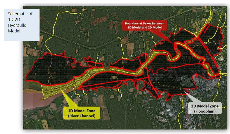
Figure 6-9: Salmon River Floodplain (CBCL, 2017)
Financial support for this project was provided in part by Natural Resources Canada through the Flood Hazard Identification and Mapping Program (FHIMP). We also gratefully acknowledge the funding and support provided by the Government of Nova Scotia through the Municipal Flood Line Mapping Program (MFLMP).

