Sackville Municipal Planning Strategies
Location and Flood Zone Description
The Sackville River and its watershed encompass a large area within the Halifax Regional Municipality and the County of East Hants in the province of Nova Scotia (Sackville Rivers Association, 2025a). The Sackville River watershed (Figure 6-7) is subject to several flood hazards, including riverine and lake flooding.
Flood Zone Adaptation Approach
Floodplain maps for the Sackville River were originally developed in the 1980s through the Canada-Nova Scotia Flood Damage Reduction Program. In 2017, updated floodplain maps were developed through the Sackville Rivers Floodplain Study. An example of differences between the 1980s mapping and 2017 mapping is shown in Figure 6-8 for Sackville Drive, showing newly identified floodway and floodway fringe areas.
Recommended flood adaptation measures identified through the floodplain study include:
-
place restrictions on future development within the floodplain;
-
implement a watershed-specific stormwater management strategy;
-
require stormwater management for un-serviced developments within the watershed.
Updated maps from the 2017 study were incorporated by the Halifax Regional Council to amend Secondary Municipal Planning Strategies and Land Use By-Laws for Bedford, Sackville, Sackville Drive, Beaver Bank, Hammonds Plains, and Upper Sackville. These amendments included updates to floodplain protection policies, regulations, and mapping (City of Halifax, 2024).
Outcome
According to a CBC news article, the proposed changes were passed unanimously by the Halifax Regional Council (CBC, 2025). The article notes concerns raised by residents, particularly related to property values and opinions that their properties should not be mapped within flood risk areas.
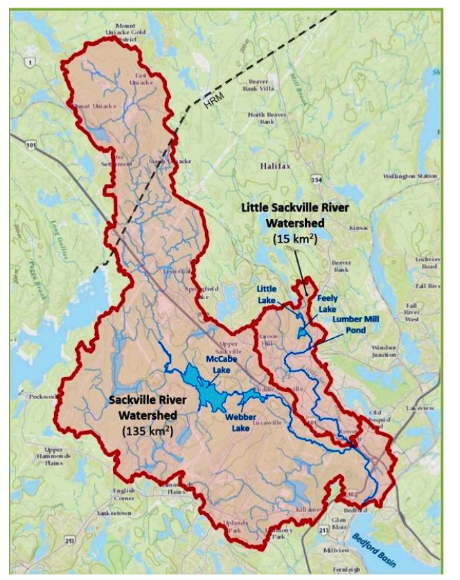
Figure 6-7: The Sackville River Watershed (Sackville Rivers Association, 2025b)
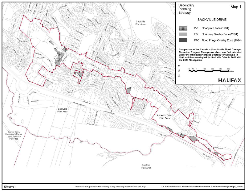
Figure 6-8: Comparison of 1984 Floodplain Zone and 2024 Floodway and Flood Fringe Overlay Zones (City of Halifax, 2024)
Financial support for this project was provided in part by Natural Resources Canada through the Flood Hazard Identification and Mapping Program (FHIMP). We also gratefully acknowledge the funding and support provided by the Government of Nova Scotia through the Municipal Flood Line Mapping Program (MFLMP).

