Grand Falls Erosion Assessment Project
Location and Flood Zone Description
The Town of Grand Falls is located in northwestern New Brunswick. Three major watercourses flow through the town, including the Saint John River, the Little River, and Falls Brook. Given the relatively high slopes of floodplains in the area, there have been numerous accounts of slope instability problems, raising concern regarding human and infrastructure safety. In response, the Town of Grand Falls initiated a slope stability, erosion assessment, and adaptation solutions study (GEMTEC, 2012). An image of the eroded bank of Falls Brook, as well as the high slope, is shown in Figure 7-9.
Flood Zone Mitigation Approach
The study outlined five goals to assist the Town of Grand Falls:
-
To provide the town with an evaluation of existing and potential erosion sites;
-
To model surface runoff within the town and to evaluate its contribution to erosion along the three watercourses;
-
To examine the land use activities which contribute to surface runoff and erosion;
-
To assess present and future risks and vulnerabilities to property along the watercourses;
-
To provide conceptual engineering solutions to stabilize existing and potential problem areas or mitigate risk to existing developments, and to provide best practices and solutions for landowners.
To address goal No. 5, which is related to the mitigation measures, the following options were considered:
-
Relocating or abandoning infrastructure at the top of the riverbanks;
-
Protection of the bottom of the slope with armour stone or riprap;
-
Storm outfalls designed to carry the runoff down to the river level without eroding the soil banks;
-
Implementation of energy dissipating drop structures.
Outcome
According to Northeast Climate Change Adaptation (2025), the Grand Falls Erosion Assessment Project is expected to support several municipal policy changes. This includes a policy to encourage homes built on sedimentary rock to consult with geological experts about possible construction issues before allowing a permit. The Town of Grand Falls will also use the study results in formulating a business plan to support different funding applications associated with a particular issue requiring remediation.
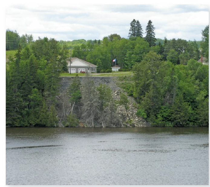
Figure 7-9: Erosion of North Bank of Falls Brook (GEMTEC, 2012)
Financial support for this project was provided in part by Natural Resources Canada through the Flood Hazard Identification and Mapping Program (FHIMP). We also gratefully acknowledge the funding and support provided by the Government of Nova Scotia through the Municipal Flood Line Mapping Program (MFLMP).

