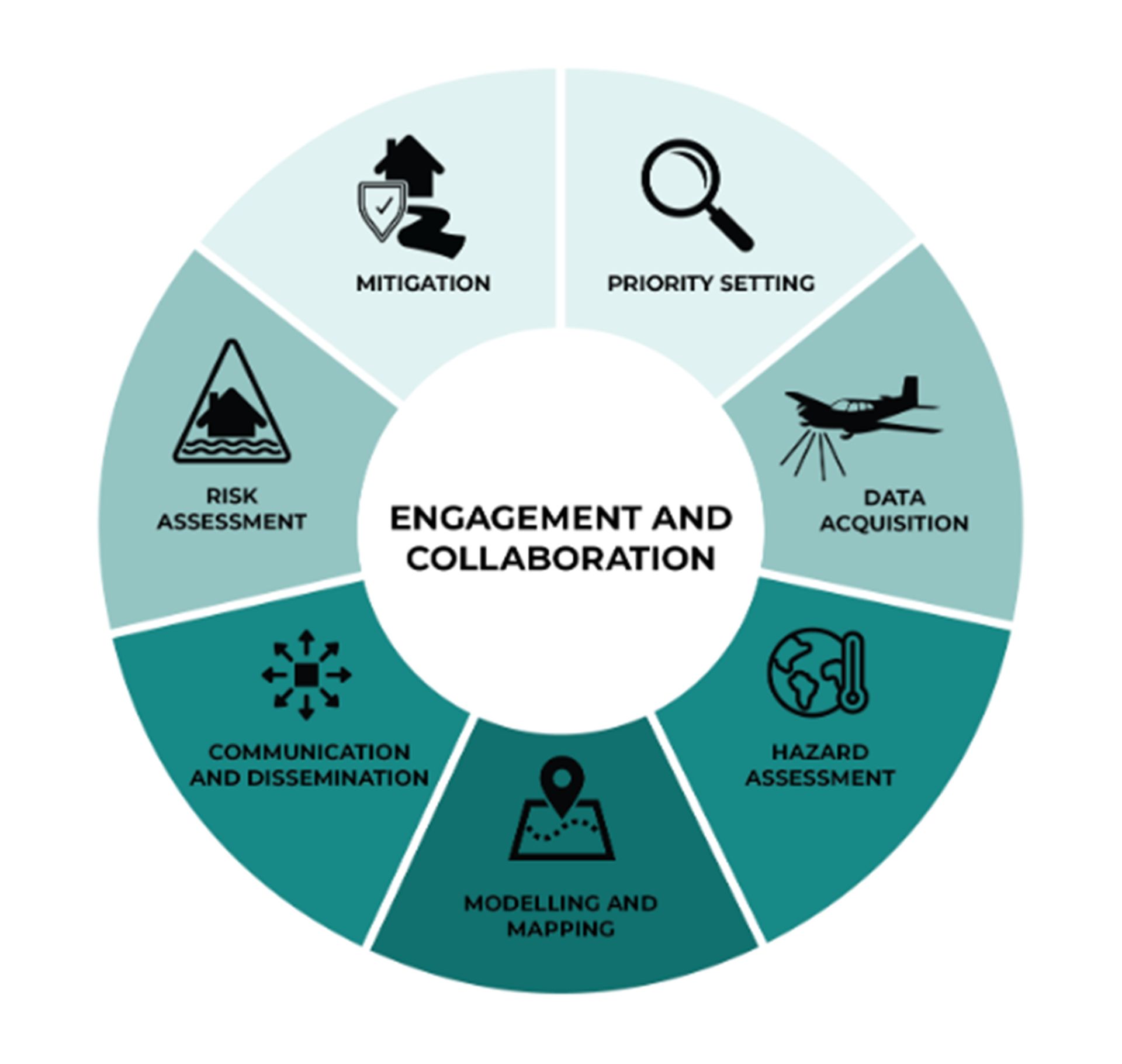
Figure 4-1: The Flood Mapping Process, According to the Federal Flood Mapping Guideline Series (Government of Canada, 2022a)
The Federal Flood Mapping Guideline Series (Government of Canada, 2025a) is a set of eleven documents that regulate and standardize flood mapping projects in Canada. These documents address each step of the flood mapping process and provide guidance to entities in Canada to understand and manage flood risks.
The eleven documents that comprise the Federal Flood Mapping Guideline Series are listed in this section (Government of Canada, 2025a). Four of the documents particularly relevant to the objectives of this report include:
- Federal Flood Damage Estimation Guidelines for Buildings and Infrastructure (Government of Canada, 2021) : this document gives guidance on how to assess and estimate potential economic losses caused by flooding, focusing on buildings and infrastructure;
- Federal Land Use Guide for Flood Risk Areas (Government of Canada, 2022a): this document gives guidance to communities in using risk-based methodologies for the purpose of land-use planning with special attention to flood-prone areas;
- Coastal Flood Hazard Assessment for Risk-Based Analysis on Canada’s Marine Coasts (Government of Canada, 2025b): this document gives guidance on methodologies for coast flood hazard assessments using risk-based approaches;
- Bibliography of Best Practices and References for Flood Mitigation (Government of Canada, 2018b): this document contains lists of Canadian and international references and case studies related to hydrology and hydraulics, climate change, risk assessment, and flood mapping.
The other documents in the series include:
- Federal Airborne LiDAR Data Acquisition Guideline (Government of Canada, 2022b);
- Case Studies on Climate Change in Floodplain Mapping (Government of Canada, 2018c);
- Federal Flood Mapping Framework (Government of Canada, 2018a);
- Federal Hydrologic and Hydraulic Procedures for Flood Hazard Delineation (Government of Canada, 2023);
- Federal Geomatics Guidelines for Flood Mapping (Government of Canada, 2019);
- Federal Guidelines for Flood Risk Assessment (in progress);
- Federal Guidelines for Flood Hazard Identification and Priority Setting (in progress).
At the federal level, the Flood Hazard Identification and Mapping Program (FHIMP) focuses on updating Canada’s existing flood mapping capabilities (Natural Resources Canada, 2025). Through this program, the FHIMP aims to complete flood hazard maps of higher-risk areas in Canada and make this flood hazard information accessible.
Financial support for this project was provided in part by Natural Resources Canada through the Flood Hazard Identification and Mapping Program (FHIMP). We also gratefully acknowledge the funding and support provided by the Government of Nova Scotia through the Municipal Flood Line Mapping Program (MFLMP).

