Alberta River Flood Response
Location and Flood Zone Description
The Province of Alberta is located in Western Canada. Alberta is subject to pluvial, lake, and fluvial flood hazards, and features several rivers that can experience significant ice jam floods (e.g., Athabasca River and Peace River).
Flood Zone Adaptation Approach
The Province of Alberta maintains a River Forecast Centre, which monitors and assesses risk related to rainfall and snowmelt that pose risks to people, property and infrastructure (Government of Alberta, 2018). The River Forecast Centre forecasts when floods will occur and actively monitors floods to identify four types of advisories including high streamflow advisory, flood watch, flood warning, and spring runoff advisory (Figure 6-5)..
These flood warnings, along with real-time flow and water level data, are available for public access through the Alberta River Basins web and application platforms (Government of Alberta, 2025b) (Figure 6-6).
The Government of Alberta also releases Flood Hazard Area maps for communities across the province, including Calgary, that reflect the latest understanding of flood risk (Government of Alberta, 2025c).
Outcome
The Government of Alberta’s river forecasting system contributes to flood awareness and resiliency in Alberta. This includes Calgary, a city that in 2013 experienced one of Canada’s largest flood events.
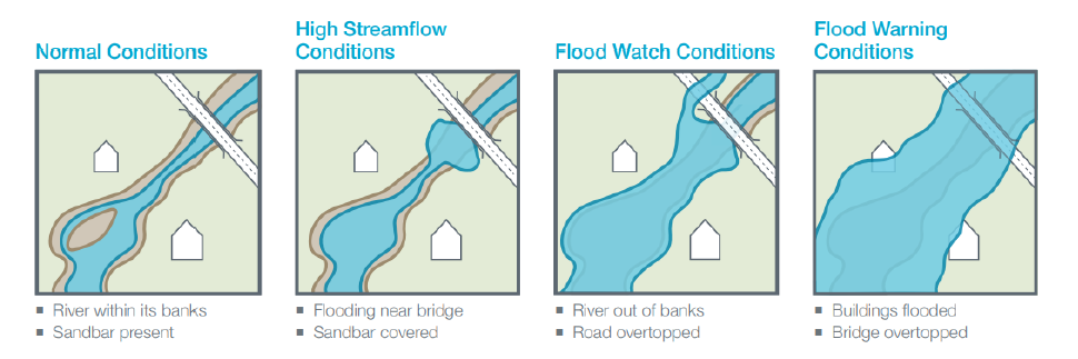
Figure 6-5: Government of Alberta Flood Warnings (Government of Alberta, 2018)
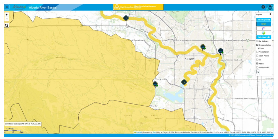
Figure 6-6: Alberta River Basins (Government of Alberta, 2025b)
Financial support for this project was provided in part by Natural Resources Canada through the Flood Hazard Identification and Mapping Program (FHIMP). We also gratefully acknowledge the funding and support provided by the Government of Nova Scotia through the Municipal Flood Line Mapping Program (MFLMP).

