Moncton Climate Change Adaptation and Flood Management Strategy
Location and Flood Zone Description
Moncton is the most populous city in the Canadian province of New Brunswick. It is located in the Petitcodiac River Valley and lies at the geographic centre of the Maritime Provinces (The Canadian Encyclopedia, 2019). Moncton is subject to several flood hazards, including pluvial and coastal flooding.
Flood Zone Adaptation Approach
The City of Moncton developed a Climate Change Adaptation and Flood Management Strategy through the Regional Adaptation Collaborative program, a cost-sharing federal program to identify and reduce impacts posed by climate change (City of Moncton, 2013). This plan was developed to understand risks and impacts related to climate change, including those related to flooding. Development of the plan relied on information from supporting studies, including the Climate Change Adaptation Measures For Greater Moncton Area, New Brunswick report (AMEC Earth Environmental, 2011).
As part of the development of the plan, four different scenarios were analyzed (City of Moncton, 2013) in order to identify flood elevations:
-
Scenario 1: High-Tide Event (2013);
-
Scenario 2: 1:100 Year Storm Event (2013);
-
Scenario 3: 1:100 Year Storm Event (with Climate Change to year 2100);
-
Scenario 4: Saxby Gale Event (with Climate Change to year 2100).
The Scenario 1 flood map (with flooded area indicated as ‘surface flooding’) is shown in Figure 6-4.
Outcome
Using the developed flood maps as a basis, several flood adaptation strategies were identified through the Climate Change Adaptation and Flood Management Strategy to reduce risks associated with flooding. These included the development of a major flood emergency response plan, increased community engagement, updating development policies and regulations, flood mitigation measures, and climate change trend monitoring.
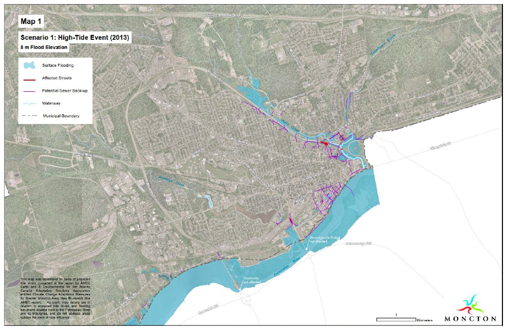
Figure 6-4: Map of Surface Flooding During High-Tide (City of Moncton, 2013)
Financial support for this project was provided in part by Natural Resources Canada through the Flood Hazard Identification and Mapping Program (FHIMP). We also gratefully acknowledge the funding and support provided by the Government of Nova Scotia through the Municipal Flood Line Mapping Program (MFLMP).

