LaPlanche Tidal River Aboiteau Replacement
Location and Flood Zone Description
The LaPlanche Aboiteau in Nova Scotia runs along the Chignecto Isthmus and protects about $40 million in provincial and municipal infrastructure, including roads and railways. Flood hazards at the aboiteau include riverine and coastal flooding.
Flood Zone Mitigation Approach
The LaPlanche Aboiteau is a structure that at low tide allows water to flow out to the Bay of Fundy, while also restricting the flow of water back into the river at high tide (Water Canada, 2017). In doing so, the structure provides protection for agricultural marshland from flooding by the Bay of Fundy.
As part of replacement of the LaPlanche Aboiteau, the opportunity to re-size and relocate the structure was identified. The primary design objectives were to decrease flooding risks under more intense rainfall and sea level rise, and to reduce dyke maintenance costs by relocating the structure downstream. The location of the old aboiteau and new site are shown in Figure 7-2, and the physical structure is shown in Figure 7-3.
Outcome
In April 2017, Government of Nova Scotia announced completion of work to replace the LaPlanche Aboiteau (Water Canada, 2017).
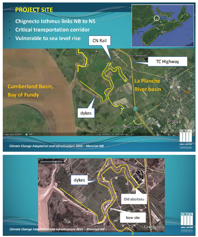
Figure 7-2: LaPlanche Aboiteau Location Source (CBCL, 2016a)
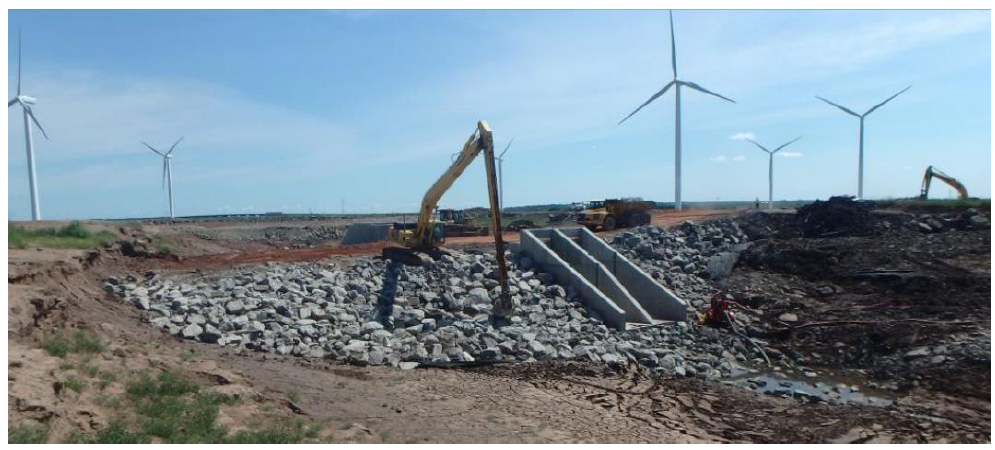
Figure 7-3: LaPlanche Tidal River Aboiteau Replacement (CBCL, 2016a)
Financial support for this project was provided in part by Natural Resources Canada through the Flood Hazard Identification and Mapping Program (FHIMP). We also gratefully acknowledge the funding and support provided by the Government of Nova Scotia through the Municipal Flood Line Mapping Program (MFLMP).

