Wide Green Dyke Around Ems-Dollard Estuary, Netherlands
Location and Flood Zone Description
The wide green dyke is located around the Ems-Dollard Estuary in the far northeast of Netherlands, near Groningen. Flood hazards at the dyke include coastal flooding.
Flood Zone Mitigation Approach
Due to the sea level rise and erosion at the Ems River Estuary, a dyke system upgrade was required. A pilot project in 2018 aimed to evaluate upgrading the existing structure by adding layers of clay dredged from the Dollard and resulting in a wider (green) dyke that merges into the existing saltmarsh, as shown in Figure 7-4. Also, the schematic of the dyke is shown in Figure 7-5.
Outcome
The wide green dyke pilot remains ongoing (Hunze en Aa's Water Board, 2025). The wide green dykes were created as part of the Danish government’s Wadden Area Delta Programme in partnership with Rijkswaterstaat’s Corporate Innovation Programme, the Rich Wadden Sea Programme, and the Rural Area Department (CLIMAtlantic, 2023c).
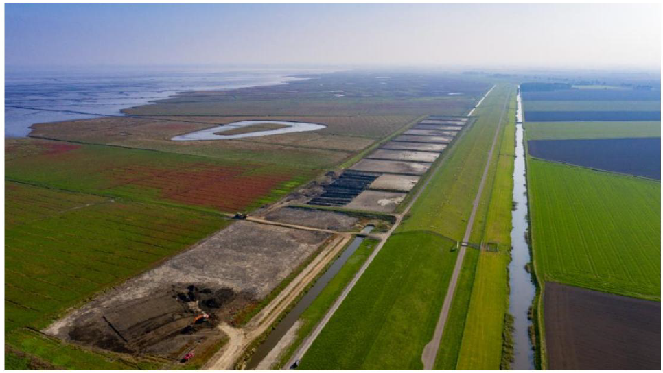
Figure 7-4: Wide Green Dyke Around Ems-Dollard Estuary (CLIMAtlantic, 2023c)
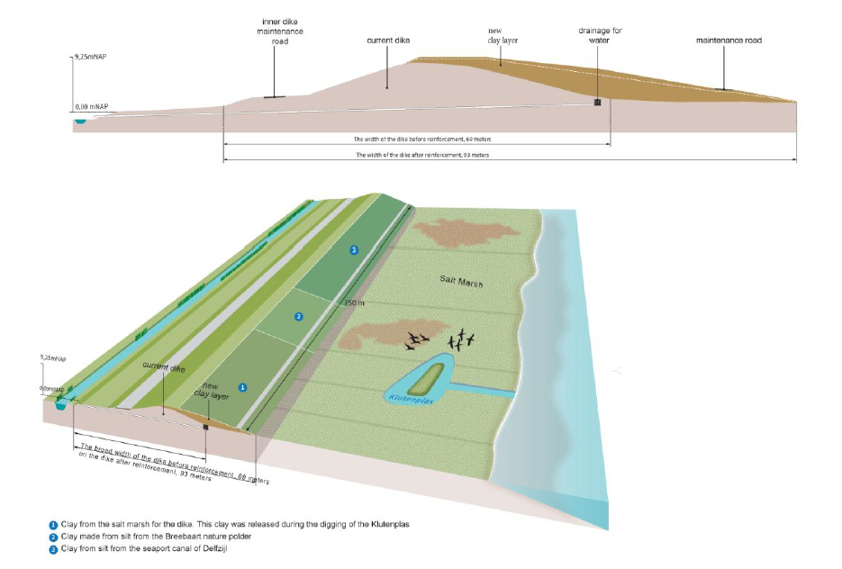
Figure 7-5: Wide Green Dyke Schematics (Ecoshape, 2022)
Financial support for this project was provided in part by Natural Resources Canada through the Flood Hazard Identification and Mapping Program (FHIMP). We also gratefully acknowledge the funding and support provided by the Government of Nova Scotia through the Municipal Flood Line Mapping Program (MFLMP).

